YCS supports the Final Recommended DRLUP
THE YUKON CONSERVATION SOCIETY SUPPORTS THE FINAL RECOMMENDED DAWSON REGIONAL LAND USE PLAN
Op-Ed, Spring 2026
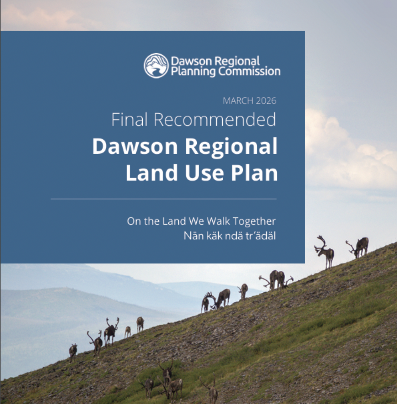
The Dawson Regional Planning Commission released the Final Recommended Dawson Regional Land Use Plan (FRP) in March [general info, [press release], marking a significant step towards respectful and sustainable management of land, water and resources in the planning region. The Tr’ondëk Hwëch’in and Yukon governments (the Parties) have plenty of consequential recommendations to consider as they work towards a consensus on the contents of an Approved Plan.
The two Parties will review the FRP over the next year or so, and then: accept it as written, reject it (although that is very unlikely, given that it incorporates both Parties’ perspectives) or vary parts of it. However, their powers to alter the text of the FRP are limited, as articulated by the Supreme Court of Canada in reference to the Peel Plan in 2016.
The FRP is quite a large document, so YCS worked to summarize several things we particularly like about it:
Heap Leaching. The FRP does not support heap leaching as a quartz mining method, at least not until it has been shown to be safe in a northern context and mining legislation has been updated. This seems like a reasonable move, given the still-unfolding catastrophe in Dublin Gulch, where the Yukon government (YG) and Victoria Gold Corp. mismanaged a heap leach so badly that it collapsed, spilling millions of litres of toxic cyanide into the environment. This puts YG in an interesting position - either it was negligent in enforcing its own regulations (which leaves it open to a massive legal action), or it was helpless in the face of an unforgiving environment (which means heap leaching is unsafe in the north and the current legislation is unfit for purpose). Despite this, YG is keen to see an even larger hilltop heap leach mine take place, the Coffee Gold Project, inconveniently situated within the Dawson Planning Region. It will be most interesting to see how the parties reach a consensus on heap leaching.
Rivers. It requires a 30-meter no-disturbance setback from rivers (the Yukon, Stewart, Fortymile, Sixty Mile, Klondike, Indian, and White rivers), which would, for the first time, impose the same riverbank disturbance rules on placer mining that apply to all other sectors.
Critical Minerals. The FRP explicitly decides to treat so-called “critical minerals” the same as all other minerals. The FRP observes that disturbances caused by critical minerals are just as disturbing as disturbances caused by non-critical minerals.
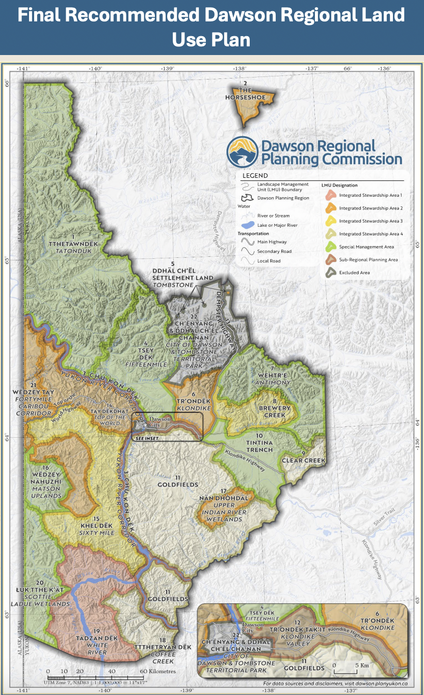
Roads. Roads are significant disturbances and breed additional disturbances. The FRP calls for Access Management Plans (AMP), which will regulate the proliferation of roads in LMUs that already have lots of roads: the busy Klondike, the Goldfields south of Dawson, and the Sixtymile area.
Caribou. If, like us, you love caribou and understand that healthy caribou populations need a healthy landscape, you will appreciate that there is a whole section devoted to caribou and their needs. The FRP includes a Cumulative Effects indicator specifically for caribou – a lichen cover indicator. Lichens are critical caribou feed and take decades to re-grow after disturbance. Areas identified as critical for the Fortymile and Nelchina caribou herds (related to migration, summer foraging, calf survival and winter range) are withdrawn from quartz-staking exploration and mining. No new roads or other permanent infrastructure are permitted above 700m, and work must stop if caribou are nearby. These critical areas are mapped as ‘overlays’ on the FRP. Importantly, these overlays apply year-round and to all activities (except placer mining below 700m). There are woodland caribou overlays too, intended for the Clear Creek, Hart and Klaza herds, which provide some habitat protection and controls on new roads.
Protected Areas. The FRP includes several LMUs (1,4,7,10,16,20) as Special Management Areas (SMAs), places intended to be managed primarily for conservation. Altogether, these add up to 43% of the planning region.
Indigenous-led Conservation. The FRP takes an innovative approach to LMU 6 (Klondike), which is west of the southern end of the Dempster Highway. It allows for most activities, except mining, and opens the door for Tr’ondëk Hwëch’in to lead the management of the area through an IPCA (Indigenous Protected and Conserved Area). These are also supported for several other areas.
Consistency with other planning regions. While the area of the region formally protected as SMAs is relatively modest (compared to the North Yukon and the Peel Watershed), other areas are withdrawn from staking, including some entire LMUs and some caribou overlays. Taken together, this places the FRP in the same bracket as the North Yukon and Peel Watershed plans.
Wetlands. Yukon’s Wetland Policy includes the ability for certain parties to nominate ‘Wetlands of Special Importance’ (WSI). The FRP nominates four WSIs. The FRP recognizes that the Yukon’s Wetlands Policy, and the designation of a WSI, does not adequately protect wetlands; therefore, it includes additional measures such as no development in any undisturbed bogs or marshes, or in fens in SMAs and WSIs. The FRP also creates no-disturbance buffers around these wetlands.
Salmon. Salmon are central to the socio-economic and cultural well-being of the Dawson Region. The FRP recognizes the role of YG in protecting the wider environment that supports salmon and calls for its regulatory tools to be updated. In addition, it addresses well-known concerns about the harmful impacts of placer mining on salmon and salmon habitat (i.e. through implementation of riparian buffers). It also identifies the effects of boats on specific environments like spawning beds and rearing areas. Interestingly, it recommends an investigation into why coho salmon are so rare in the planning region.
We hope this article has provided a useful look at some highlights from the FRP. For further reading, we strongly suggest the Dawson Regional Planning Commission’s Decision Document, which summarizes how it considered and decided upon the proposed modifications offered by the Parties during the last round of revisions to the Recommended Plan. Further FRP documents can be found here, including a map and an overview of the plan.